

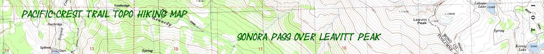

Sonora Pass over Leavitt Peak
PCT
Onto the East Flank of the Sierra Nevada
Topographic Hiking Map
The Pacific Crest Trail skirting the East Edge of the Emigrant Wilderness
Four 7.5 minute USGS Topo Backpacking Maps

Maps |
MAP |
MAP |
MAP |
Trail |
30 Minute MAP NORTH Carson Iceberg Wilderness |
30 Minute |
PCT |
TYT |
Click |
All All |
RESUPPLY |
PERMITS |
WEATHER SONORA PASS HIGH SIERRA WEATHER |
Road Map AND Map Information |
Pacific Crest Trail
Topo Hiking Map
South
from
Sonora Pass over Leavitt Peak
&
into the
North Yosemite Backcountry
CLICK
RED DOTS
For
Trail Guide Entries
CLICK
LABELS POINTING to ADJACENT TOPO HIKING MAPS
&
MAGNIFY THIS MAP!
| PCT topo MAP NORTH Boulder Lake to Sonora Pass |
TYT topo MAP NORTH Clarks Fork to Saint Marys Pass |
PCT to TYT Topo Map WEST to TYT Down Kennedy Creek |
CLICK |
PCT-TYT Topo Map SOUTH Jack Main Canyon |
West Walker to Kerrick Canyon or Twin Lakes MAP SOUTH Upper Piute Meadow to Buckeye Pass |
|
| PCT topo MAP NORTH Boulder Lake to Sonora Pass |
TYT topo MAP NORTH Clarks Fork to Saint Marys Pass |
PCT to TYT Topo Map WEST to TYT Down Kennedy Creek |
100% Size Map CLICK THE |
PCT-TYT Topo Map SOUTH Jack Main Canyon |
West Walker to Kerrick Canyon or Twin Lakes MAP SOUTH Upper Piute Meadow to Buckeye Pass |
Location Information |
||||
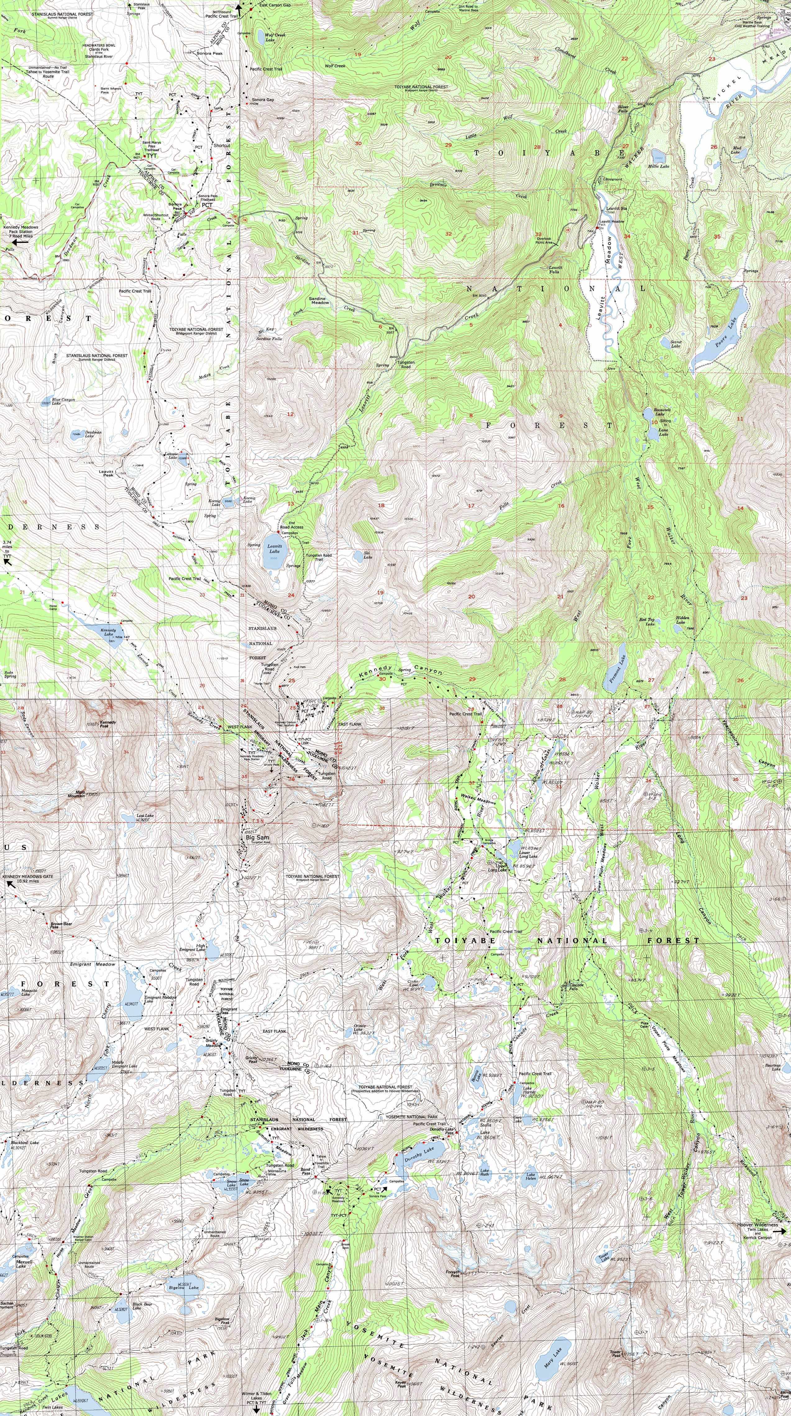
Main Features I expanded the scope of this Pacific Crest Trail map East to include the Leavitt Lake and Leavitt Meadow trailheads which show access to the PCT South of Sonora Pass from lower down the Eastern flank of the Sierra. Leavitt Lake is accessible up the Tungsten Road. The Tungsten Road is a rough four wheel drive road heading South and upward from Highway 108 on the East flank of the Sierra below Sonora Pass, while Leavitt Meadow's trailhead sits along Highway 108 way down the mountain's Eastern flank. Check out the full route of the trail up the West Walker on the Sonora Pass to Bensen Lake 30 minute map. Though the four-wheel drivable section of the Tungsten Road ends at Leavitt Lake, its route continues past the Lake into the Emigrant Wilderness to meet up with the Pacific Crest Trail on the Southeast end of the Leavitt Peak Massif. The Tungsten Road and the Pacific Crest Trail share route for the short hike down to the Kennedy Canyon trail junction. At the Kennedy Canyon trail junction the PCT turns East down Kennedy Canyon while the Tungsten Road continues South over Big Sam into the Emigrant Basin, where it intersects with the Tahoe to Yosemite Trail under the shadow of Grizzly Peak in Grizzly Meadow. The trail up from Leavitt Meadow Pack Station intersects with the PCT further East and further down the Eastern Sierra Flank. The trail up to the Pacific Crest Trail from Leavitt Meadow has a few possible alternative routes to reach two trail junctions along the Pacific Crest Trail in the West Walker River watershed. No matter how we hike it we will either hook up with the Pacific Crest Trail on the East side of the bridge over the West West Walker or through Cascade Creek. The Pacific Crest Trail turns West down Kennedy Canyon on the South side of Leavitt Peak, where the actual trail route on the ground differs significantly from that on the map caused me pause. Last time through Kennedy Canyon I counted two fords of the creek while the map shows none. Closer inspection of the trail showed my upper ford is a seasonal wash. Continuing South on the Pacific Crest Trail at the bottom of Kennedy Canyon the trail routes between the Pickle Meadow and Tower Peak 7.5 USGS topo maps do not match up. I scouted around and found isolated remnants of of the old trail. I noted and marked the current trail route around the Southeast corner of Kennedy Canyon on the topo hiking map above as of July 2012. There is no problem hiking North or South along the Pacific Crest Trail through Kennedy Canyon. The trail is well maintained and the trail junctions are clearly marked even if misrepresented on the map.
MAP NOTE What's important for our general reference purpose is that each side of a square is 1000 meters, or a Kilometer. From my point of view that is 1093.6 yards or .62 of a mile. Diagonal: 1414.22 meters, if my trig is correct. That converts into 4,639.8 feet or .88 of a mile.
top of page |
Road Map |
Mileage, Mapping, Permits, and National Forest Information |
|
High Sierra Trailheads Highway 108
Sonora Pass
|
Miles South
Sonora Pass to Tuolumne Meadows
Sonora Pass Trailhead Shortcut junction via PCT
Gap above North side of Latopie Lake
Gap above Kennedy Lake
Tungsten Road Junction
Kennedy Canyon trail junction
Physical location |
Four USGS Northwest Map Contours: 80 feet
Southwest Map Contours: 40 feet
Northeast Map Contours: 40 feet
Southeast Map Contours: 40 feet
Compass Offset
100% Size Map |
| Backpacking Permits West & East |
||
West Side and Sonora Pass Stanislaus TahoetoWhitney Contacts Page
National Forest Wilderness Area information
|
East Side Leavitt Lake and West Walker through Leavitt Meadow and Sonora Pass Toiyabe
|
|
When driving West up Highway 108 from Hwy 395 I have obtained permits from the Bridgeport office for hiking areas that are within the Stanislaus National Forest. Likewise I have obtained permits from the Stanislaus for hikes in the Toiyabe when I'm driving East over Highway 108. It appears that the National Forests have permitting reciprocity for hikers far from the proper Ranger Office for the permit they need. I figure that they issue you the permit and then transmit that permit information on to the proper office. This courtesy can save significant travel time and travel when we are on the road. |
||
PCT topo MAP NORTH: Boulder Lake to Sonora Pass TYT Topo MAP NORTH: Clarks Fork to Saint Marys Pass Topo Map WEST to TYT: Down Kennedy Creek Topo Map SOUTH to TYT: Big Sam to Emigrant Meadow PCT topo MAP SOUTH: Kennedy Canyon to Bond Pass
| Elevations | More Information | ||
Sonora Pass: 9643 feet Trail high point on Leavitt Peak: 10, 800 feet Kennedy Canyon trail junction: 9680 feet |
Trail Guide, Section: Sonora Pass to Tuolumne Trail Guide, Segment: Emigrant Wilderness & Toiyabe National Forest Google Road Map: Above |
||
Map Credit |
U.S. Geological Survey, Department of the Interior: The USGS Download USGS Topo Hiking Maps Move the Map to the Sierras. Select size of Maps you wish to locate. Click "Mark Point" on map to see the USGS map grid of the selected map scale. |